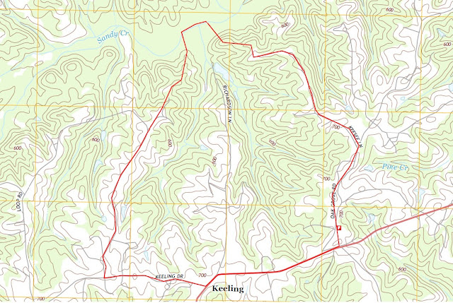
With so much rain and runoff, I thought it be a great day to check out the Richardson Lane Watershed and see what was happening with water levels and what kind of conditions the local runoff was in.
We explored the middle to southeastern portion of Tributary East. The goal was to reach the headwaters, but past logging and the thick under story prevented us from going all the way.
 |
| Photo by: Briana Bill The water is up! |
 |
| Photo by: Briana Bill
Deer sign in the watershed. His and hers scat. Buck to the left, doe to the right. We found an area with heavy foraging and a bedding area.
|
 |
| Photo by: Briana Bill A deer rub near the bedding area. |
 |
| Photo by: Briana Bill We traveled south along the stream bank and found this little waterfall. |
 |
| Photo by: Briana Bill |
 |
| Photo by: Briana Bill
As we traveled upstream, the under-story changed. The stream bank became thicker with smaller diameter trees and shrubs. The herbaceous layer was much thicker.
|
 |
| Photo by: Briana Bill
Further upstream the stream narrowed and became overgrown with vegetation and lots of brambles. It became difficult to maneuver through the underbrush. It appears this messy riparian zone is a result of past logging. The clearcut was taken all the way to the stream bank. There was no buffer provided by the logging and the result is overgrowth of vegetation. It is a typical practice in this area to clear cut right through the headwater streams as they are not incised and don't provide much of an obstacle.
|
 |
| Photo by: Briana Bill
We left the stream to go around and try to find the headwaters further upstream. As we traversed the hillside, we came across a very large beech tree, with a very small praying mantis attempting to scale the vertical trunk.
|
 |
| Photo by: Troy Shelton While not a monster, this is a large tree for this watershed. It was very tall. |
 |
| Photo by: Troy Shelton
We hiked up to an up-gradient tobacco field. At the edge of the field were large rocks that had been removed from the field years ago. They were stacked up in a row.
|
 |
| Photo by: Briana Bill At the forest edge, over looking the tobacco field. |
 |
| Photo by: Briana Bill
While runoff was occurring at this field, the vegetated roads and forested buffers provided good erosion control. This was the worst spot at the field's edge.
|
 |
| Photo by: Briana Bill
We could not follow the stream through the vegetation and stopped left of this photograph. The stream entered a pasture and is evident by the line of regrowth of trees and saplings.
|
 |
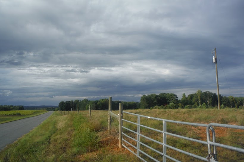
| Photo by: Briana Bill
The pasture is maintained to provide a forested stream buffer. The buffer is thick enough that the resident cattle avoid the stream. The farmer also provides a watering trough to discourage the cattle from the stream. The regrowth of trees outlines the general boundary of the headwaters.
Watershed Walk Route
|

Google Maps 2015